MEJOR’s Maps Reach Headlines in Portugal: What the 2026 Wildfire Susceptibility Map Revealed About Portugal

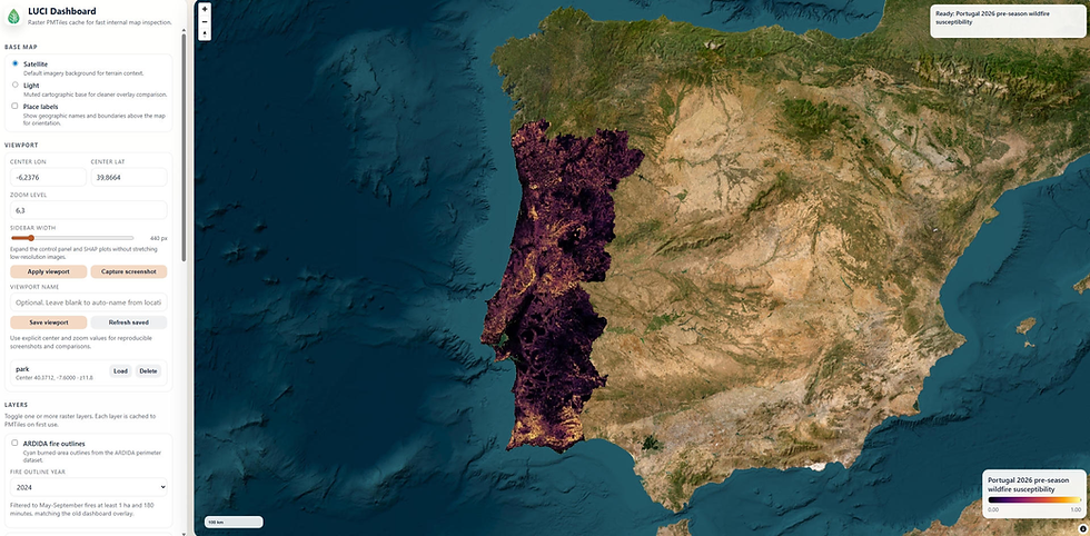
For the first time, landowners and municipalities in Portugal can see how this season’s wildfire conditions differ from the long-term picture. This is thanks to MEJOR’s LUCI technology, which mapped the risk parish by parish across all 3,049 mainland parishes.
A wetter-than-usual winter and an early warm spring have left roughly one in three mainland parishes with elevated vegetation and fuel signals for 2026, rising to two in three in the popular tourist region of the Algarve.
MEJOR Technologies built the 2026 Wildfire Susceptibility Map for LandOS using LUCI satellite technology. LandOS then analysed the data to determine its real-world implications and used its A Minha Terra platform to share those findings with landowners and the public.
That combination of MEJOR’s never-before-seen mapping with LandOS’s analytical read and activation produced something genuinely new: insight practical enough to guide landowners and compelling enough to earn national attention. Thirty-five articles across national newspapers, specialist forestry outlets, regional media and English-language publications attracted nearly 500,000 estimated views.
A Current View of Portugal’s Landscape
The 2026 Wildfire Susceptibility Map covers all 3,049 parishes in mainland Portugal at a resolution of 10 by 10 metres. MEJOR Technologies developed the map for LandOS using LUCI to combine recent satellite observations with information about land cover, vegetation condition, terrain, human presence and recent fire history. LandOS analysed the resulting dataset and made the findings accessible through its A Minha Terra platform.
The result is a seasonal layer that complements the official structural hazard map published by Portugal’s Institute for Nature Conservation and Forests (ICNF).
The distinction matters. Structural mapping shows the enduring geography of wildfire hazard over the long term, while the seasonal map reveals where vegetation and fuel conditions in 2026 differ from that established pattern. Together, they provide a more complete and current view of the landscape, helping landowners and municipalities focus prevention efforts where they matter most.
This approach was introduced nationally by Público and Observador, before being carried by news organisations across the country.
The Findings That Resonated
The coverage highlighted how an unusually wet winter and an early warm spring encouraged vegetation growth in areas where seasonal conditions now appear more concerning than the long-term structural picture alone would suggest.
Around one in three mainland parishes shows elevated vegetation and fuel signals for the 2026 season. In the interior Algarve, that rises to two in three parishes. Jornal de Notícias brought this regional finding to a national audience, while Voz do Campo explored the wider data story.
Regional reporting made the national map locally meaningful. Tribuna Alentejo focused on heightened vigilance in the Alentejo, while Diário do Alentejo highlighted Odemira, Mértola and Ourique.
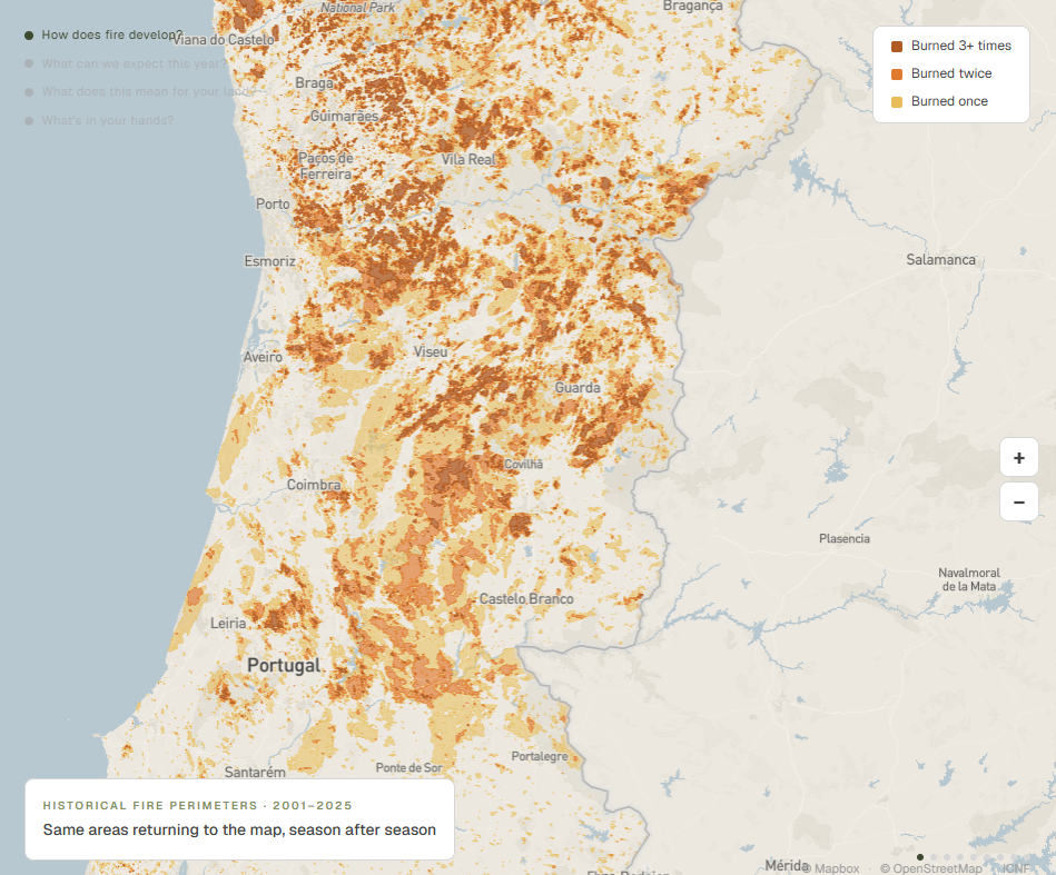
The map also tells a more nuanced story than a simple nationwide increase. In parts of Portugal’s central interior, including areas around Pampilhosa da Serra, Arganil and Covilhã, seasonal susceptibility is lower than the structural reference. Fires in 2025 consumed much of the available vegetation, and regeneration has not yet fully recovered.
These areas remain structurally exposed over the long term, but their immediate fuel conditions are different in 2026. That contrast is precisely why current Earth observation can be so valuable: it helps distinguish the persistent geography of wildfire hazard from the conditions present this season.
Turning Information Into Practical Steps
Media interest extended beyond the map itself. A second strand of coverage focused on the free A Minha Terra land-clearing checklist, which translates technical information into practical recommendations for individual properties.
Landowners can enter a property’s location and receive suggested vegetation-management actions adapted to factors such as the parcel, slope, nearby buildings and seasonal conditions. The process takes less than five minutes and is designed to help people move from awareness to action.
Notícias de Coimbra examined the role of artificial intelligence in helping rural landowners prevent fires. Specialist forestry platform Florestas went further into how the platform connects official structural information, recent satellite data and practical vegetation management.
A National Conversation With a Local Purpose
The story appeared at every level of the Portuguese media landscape.
We are grateful to the journalists and publications that brought this work to readers across Portugal. The breadth of the coverage reflects a shared need for wildfire information that is timely, local, understandable and connected to practical action.
Satellite intelligence can reveal where this season differs from the long-term pattern. A well-designed platform can turn that insight into guidance for a particular piece of land. But the outcome that matters is what happens next: a landowner who knows where to focus, a municipality with a clearer view of changing conditions, and more prevention work completed before a fire begins.
See what the 2026 season looks like where you live, work or manage land. Explore the interactive Wildfire Susceptibility Map, search your area and turn a national picture into insight you can act on locally.


Comments